Isidore of Seville, Etymologiae, Books I-XX
- Tournai Map Maker
Manuscript in Latin on vellum
Northern France, possibly Saint-Amand Abbey, 950-980 and Tournai, Saint-Martin Abbey, additions before c. 1150.
310 x 224 mm
Price on request.
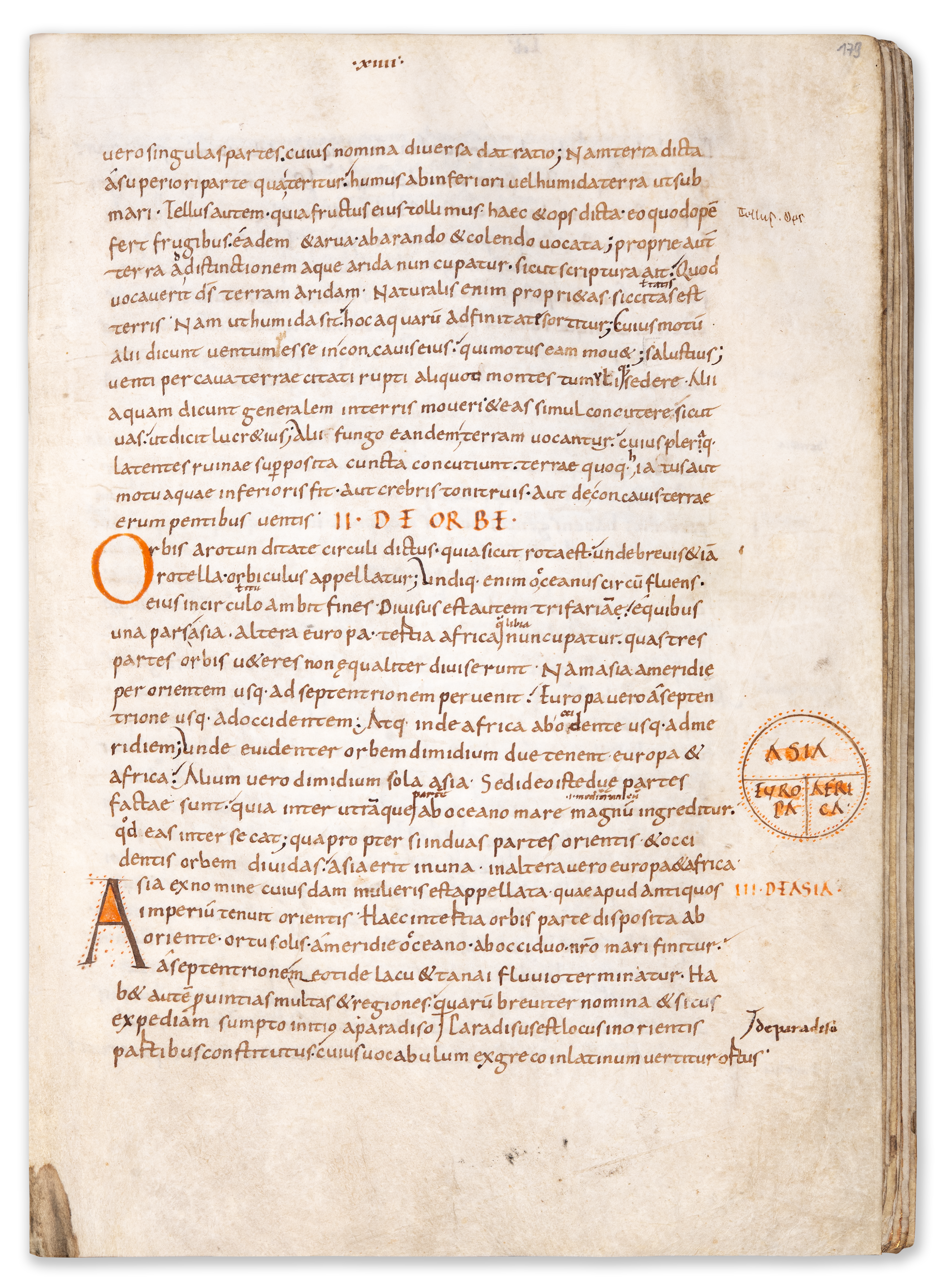
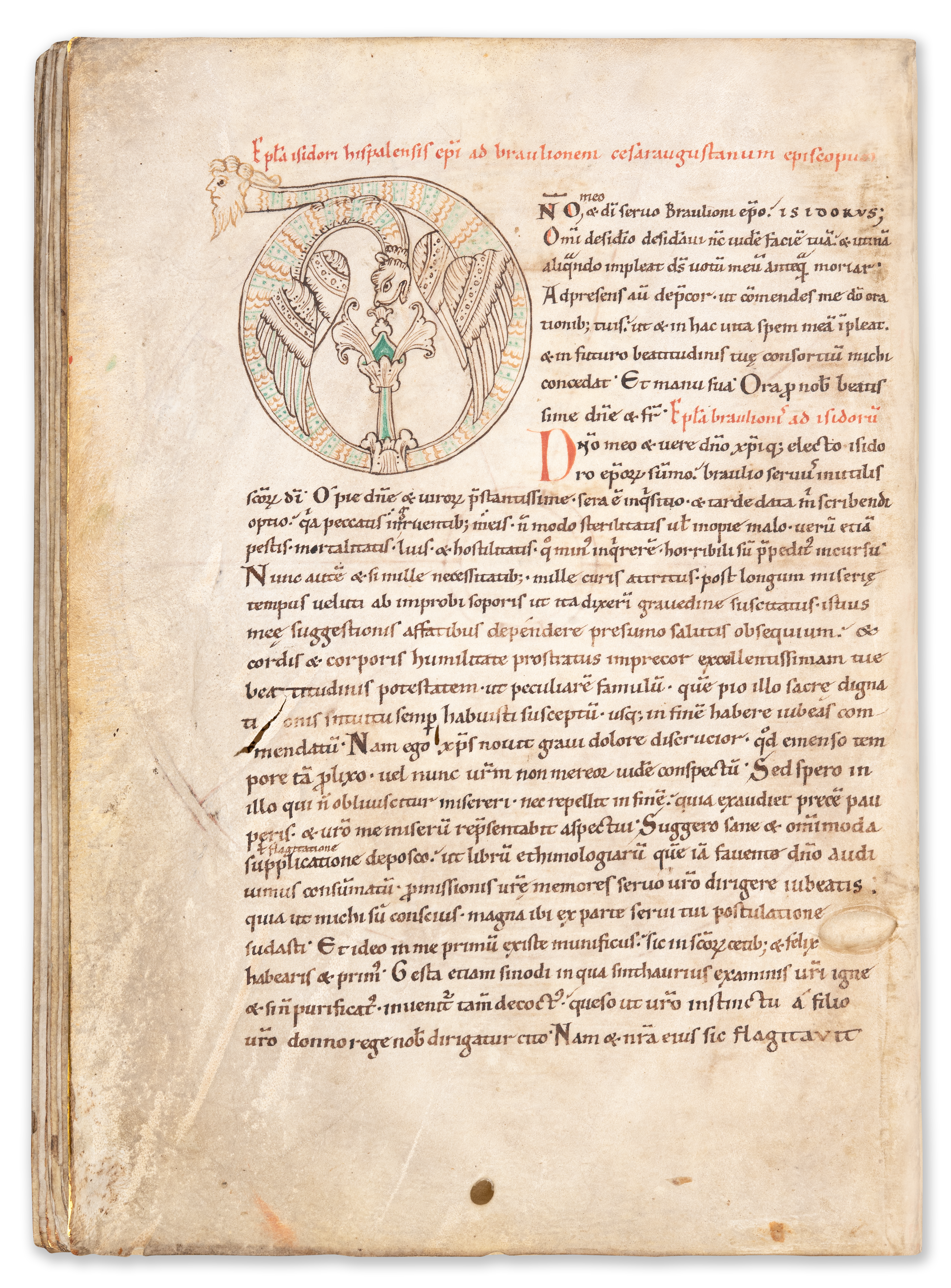
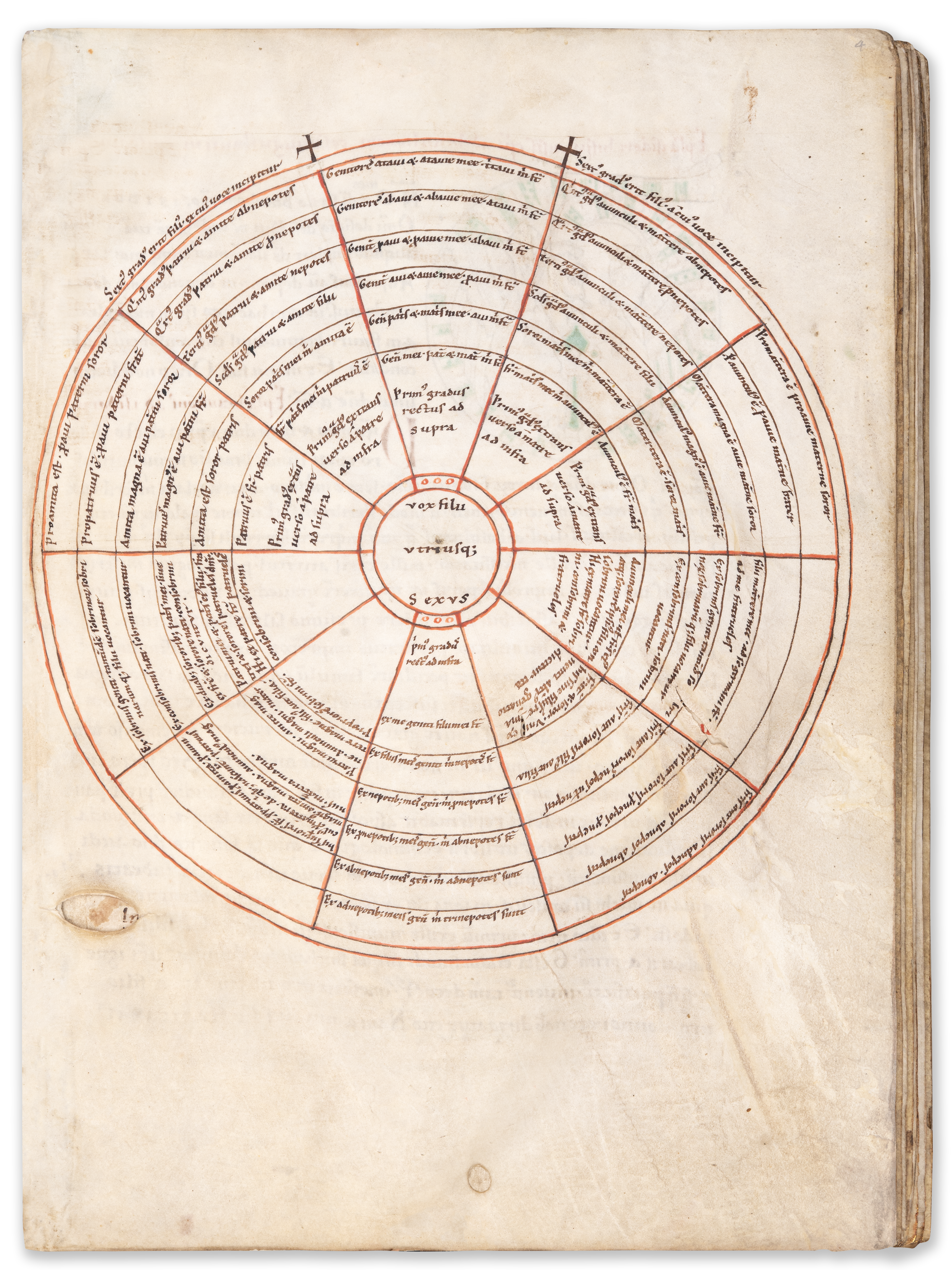
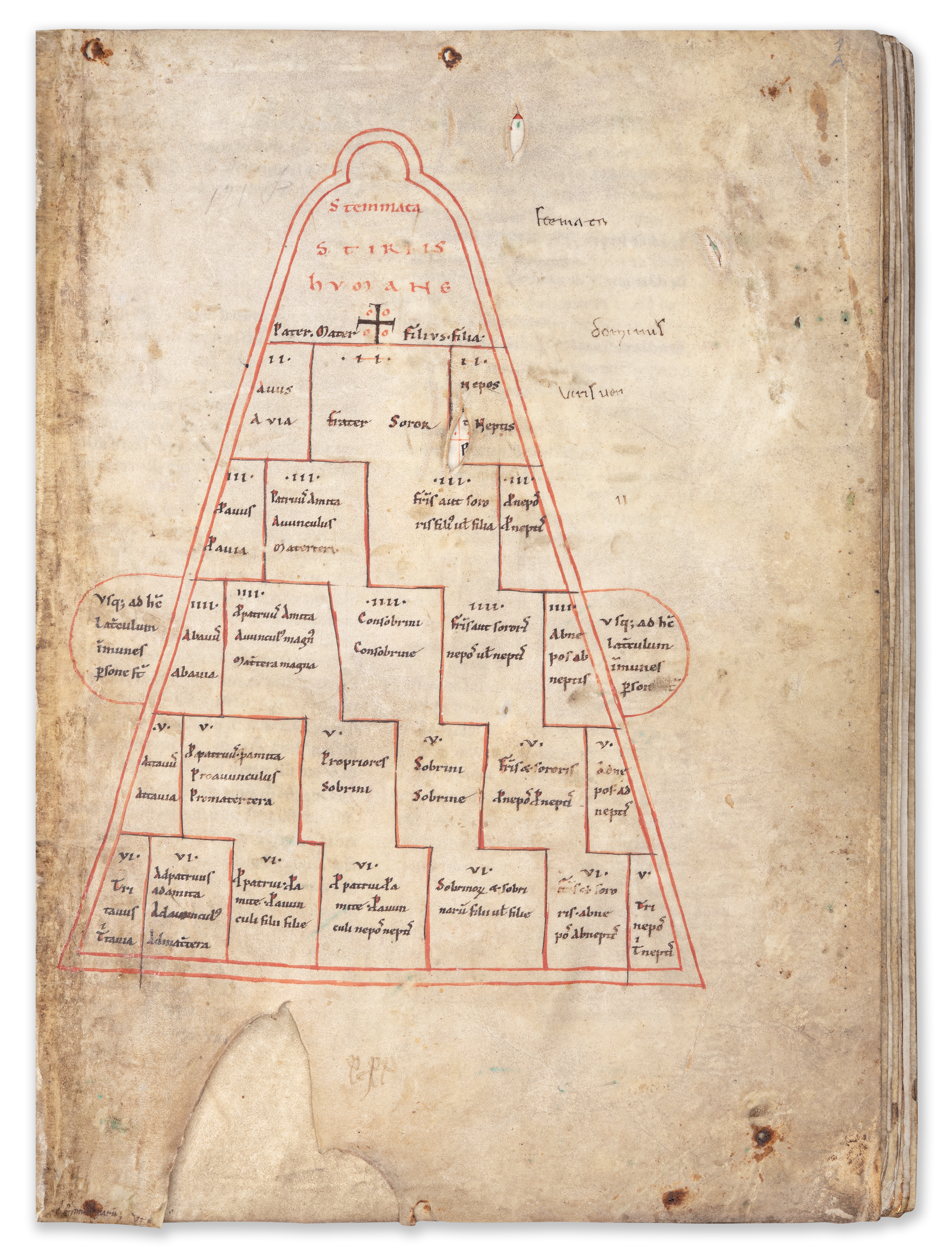
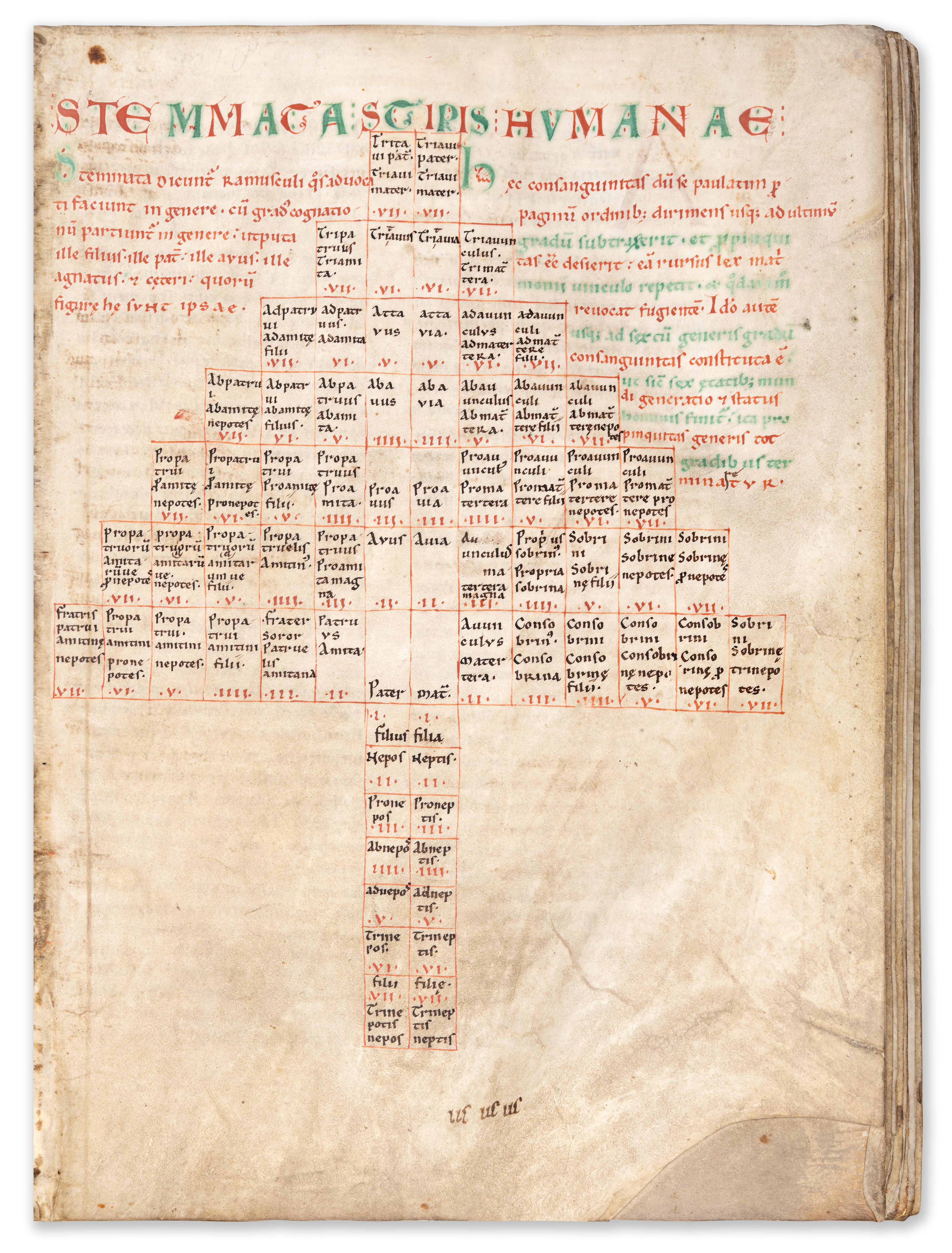
i + 267 + I ff. 1 large zoomorphic initial, 5 pages with small interlinear diagrams, 1 marginal T-O Map, 3 full-page diagrams on human relationships and 1 inserted map of Anatolia (12th century additions). Complete. Rebound in a modern binding after 2018. Very good condition.
The Etymologies of Isidore of Seville is by far the most important encyclopedic treatise of the Middle Ages (as attested to by the great number of surviving intact or fragmented manuscripts), and this tenth-century book is probably the oldest witness to this text available on the market.
Isidore’s of Seville’s (d.636) concentrated a large body of knowledge in a vast reference work that functioned as an etymological encyclopedia. Covering a range of subjects, including the seven liberal arts, and written in uncomplicated Latin, the book found preeminent use in education.
Books I-III deal with the concept of the Seven Liberal Arts, Book IV and part of V deal with medicine and law, Book VI-VIII are on sacred sciences, Book IX on human institutions and organization (from languages to kinship), Book X on terms – alphabetically ordered – descriptive of humans, whereas Book XI deals with the anatomy of human beings. The organizing principle of the second decade is encyclopedic, with Books XI-XVI concerns the natural world, Book XIV on countries and regions and Book XV on cities and things built by humans; Books XVII-XX treat human institutions, artefacts and activities (Book XVII concerns agriculture, animals and minerals).
Isidore’s main interest is grammar, the art of understanding and correctly producing words and texts and the foundation of the liberal arts. He illuminates the essences, etymologies, of words in terms of grammar.
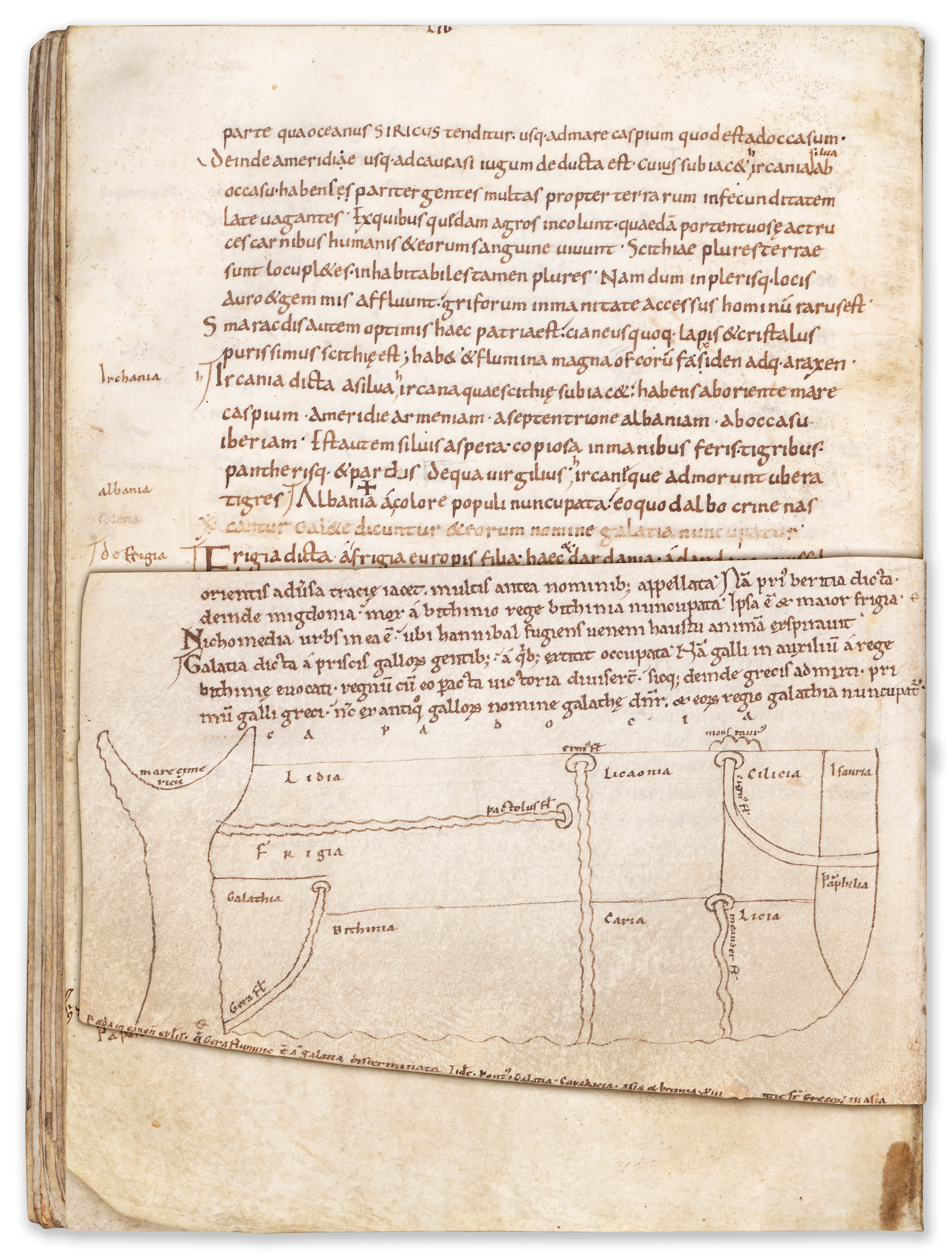
The most extraordinary feature of this manuscript, however, is the inclusion of a map of the regions of Cappadocia on f. 182v. The original campaign had omitted verse 34-38 (of chapter iii, of Book XIV), and when the text was corrected in the 12th century this section was added on a parchment fragment and completed with a map of the region. The map lists the regions of Cappodocia (Lidia, Frigida, Bithinia, Galatheia, Caria, Liconoa, Cilica, Licia, Isauraia, Pamphilla) as well as neighbouring ocean (Cimerian Sea), mountains (Mount Tauraus) and several rivers in the region (Meander and Cignus). At the bottom of the parchment leaf is an extract from Bede on the region: Beda in canonicas epistulas: quae Gera flumine est a Galatia disterminata and idem: Pontus, Galatia, Cappadocia, Asia et Bitinia provintie sunt Grecorum in Asia. Intrguinly, the map includes the river Hiera, which is mentioned by Bede, but not Isidore, and the river Meander, which is not mentioned by either scholar.
These additions are the work of the Tournai Map Maker who was active at Saint-Martin’s in the 12th century. He is the author of two famous maps at the end of a manuscript now in London (BL, Add MS 10049), Jerome’s translation of the Interpretation of the Hebrew Names and other texts.